Hiking
Hiking
The Low Tatras offer many opportunities for lovers of hiking from easy to more challenging routes. Apartments Jasná and apartments Biela Púť are situated at an altitude of app. 1120 m above sea level directly at Biela Púť which is an ideal starting point for many hiking routes. We will be glad to advise you regarding the selection of routes and in our shop near the apartments we have everything you need, including tourist maps and whistles to scare away bears.
We recommend
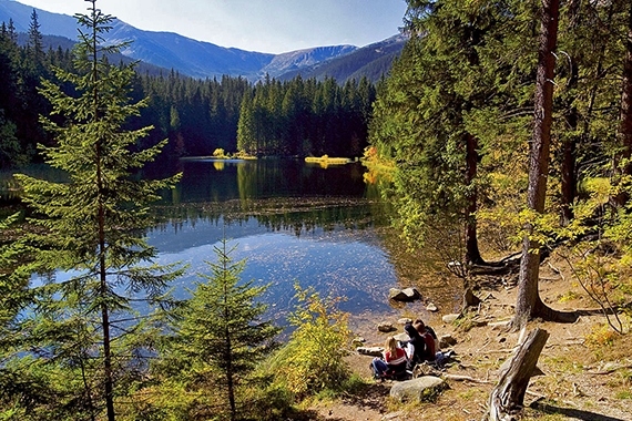
Vrbické tarn
Vrbické tarn is a glacial lake and the largest natural lake in the Low Tatras. It is located at an altitude of 1113 m above sea level in the top western part of Demänovská valley. It covers an area of 0.69 hectares, has a maximum depth of 8 m, a length of 115 m and width of 62 m. It is a moraine lake which was created after the retreat of glacier from the northern slopes of Chopok peak and Dereše.
Route description
From the parking place behind the Wellness Hotel Grand Jasná there is a path leading to the Vrbické tarn. On the right side of the tarn there is a educational path with information boards, which continues to Tri Vody (Three Waters). Beside the tarn you can relax on benches in the silence of forest and enjoy the view of the surrounding ridges of the Low Tatras.
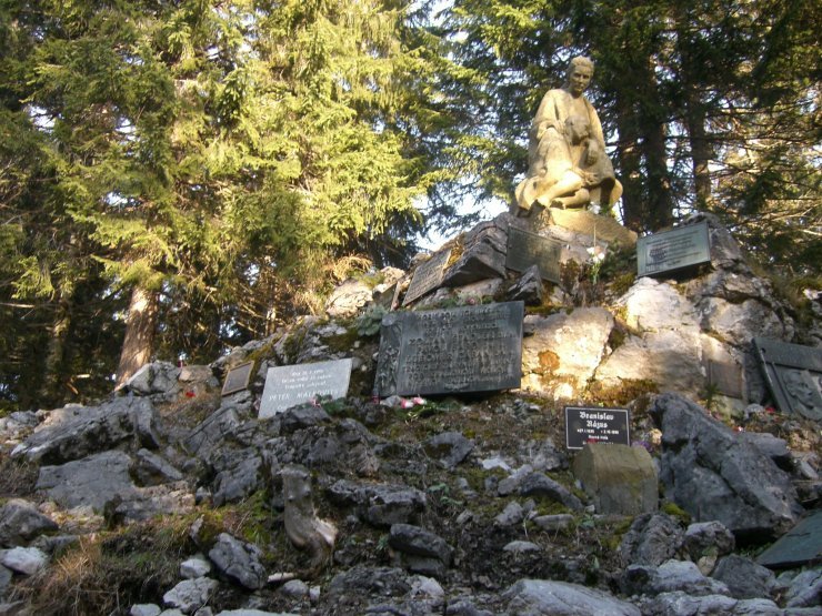
Symbolic cemetery and observation
Route description
From the main road at Biela Púť turn at the cross and follow relatively undemanding yellow marked tourist route leading along the observation tower, where you can enjoy the view of the northern side of Chopok peak and Demänovská valley up to the symbolic cemetery of the Low Tatras victims.
Alternative route: 2a: Following a longer path you can continue walking on the yellow marked route (+2.6 km,+1 hour) which will lead you to the Demänovská Ice Cave. Go down the same route back to the Symbolic cemetery.
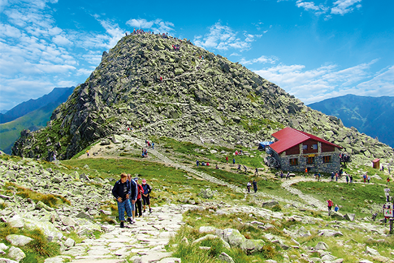
Chopok peak
Route description
Parking place Biela Púť (yellow marked) – Tri vody – saddle Poľany (red marked) – Dereše – Chopok peak– Demänovské saddle – Krúpovo saddle (green marked) – crossroads Široká valley – under Krčahovo – Lúčky bus stop
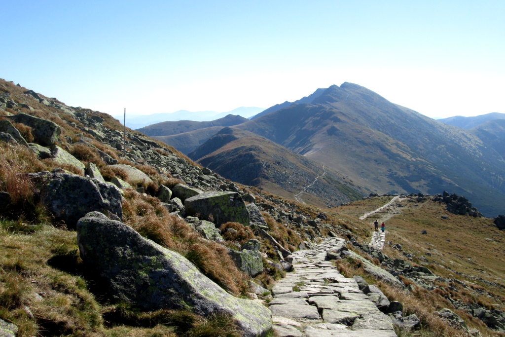
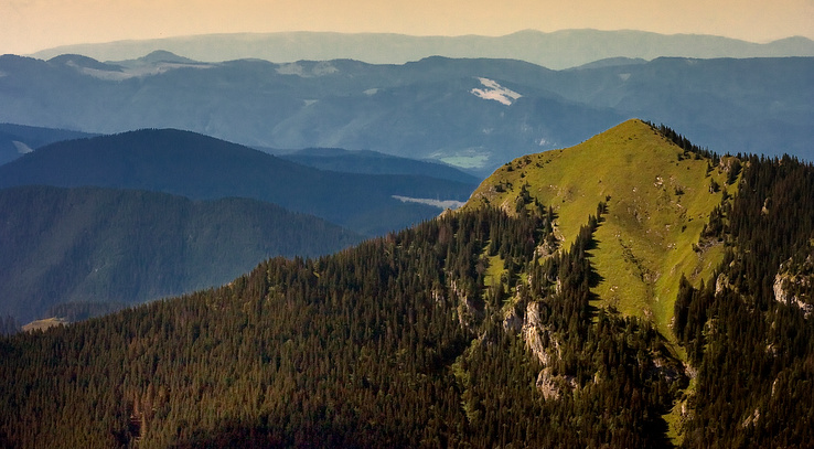
Chopok peak - Ďumbier peak
Route description
Route description: The route is the red marked path from Kamenná challet under Chopok peak through Demänovské saddle (1756 m above sea level) and Krupová hoľa up to the highest peak of the Low Tatras – Ďumbier peak (2043 m above sea level) with a very large panoramic view of almost all mountains of central and northern Slovakia. Follow the same route back to Chopok peak.
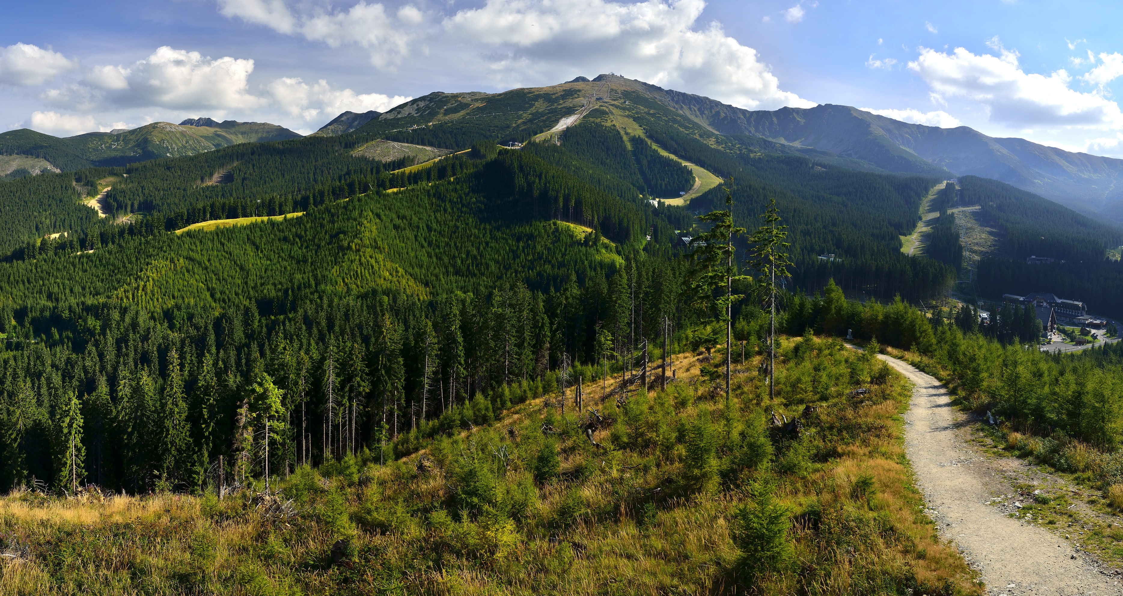
Education path Demänová valley
Route description
Hike of medium difficulty hike leading at its entire length down the educational path Demänovská valley with 12 information panels. One of the most beautiful paths in the Low Tatras.
Start: Wellness The Hotel Grand Jasná, parking place
Finish: Lúčky, bus stop
Educational path: The educational path and the first instructive board begin behind the wellness Hotel Grand Jasná, the route continues along Vrbické tarn and Mikulášska challet towards Otupné and Tri Vody. Turn left to the red marked tourist path to Brhliská, continue under Orlia rock and the path steeper rises to Luková. Then it descends to Pekná and traverses to the crossroads in Široká valley. We continue left along the green marked tourist path up to Lúčky.
Siná
Route description
We begin to climb from the signboard Demänovská Cave of Freedom (830 m above sea level) along the blue marked tourist path. After 300 m we come to the crossroads. From there we continue along the yellow marked path through the saddle of Siná (1300 m above sea level) to the top Siná (1560 m above sea level). The summit offers a view of Liptovská Basin, the Western Tatras, Demänovská valley, ridge Bora and the central ridge of the Low Tatras. Return - the same route.